A single line on an astrocartography map marks one planet on one angle. A crossing is a place where the lines of two different planets meet, so two themes are emphasised at once. It is one of the most searched ideas in the field, and one of the easiest to over-read.
This guide uses one worked chart, the same Hangzhou birth (22 August 1994, 18:30) as the Descendant guide, and finds every crossing with the same engine as the free line crossings finder. Every number below is calculated, and a 300-chart sample shows how typical the example is.
Two lines, one place
Each of the ten planets has four lines. The Midheaven (MC) and IC lines are straight north-south meridians; the Ascendant (ASC) and Descendant (DSC) lines are curves that bend with latitude. A crossing is where a line of one planet meets a line of another. A planet's own lines are not counted against each other, and two meridians never meet because they are parallel.
The worked chart has 145 crossings between 70°S and 70°N. In 92 of them a meridian cuts a horizon curve; in 53 two horizon curves meet.
What the crossings are made of
Meridian lines (Midheaven and IC) are straight; horizon lines (Ascendant and Descendant) curve. Pairs can also be sorted by the planets’ traditional character.
Mixed pairs, one supportive and one hard planet, are the most common. Both columns are for the one sample chart.
The three colours sort pairs by the planets' traditional character: Sun, Moon, Mercury, Venus and Jupiter as supportive, Mars, Saturn, Uranus, Neptune and Pluto as demanding. Most crossings pair one of each. That is a convention for reading, not a verdict on a place.
Why most crossings are nowhere near a city
Count the crossings by latitude and the pattern is lopsided. Only 2 of the 145 fall within 15° of the equator and 14 within 30°; 85 lie between 60° and 70° latitude. Horizon lines bend toward the poles and crowd together there, so they meet each other far from where most people live.
Most crossings lie far north or far south
The sample chart has 145 crossings between the ten planets’ lines. Counted by latitude, they bunch toward the poles.
Horizon lines bend poleward and crowd together at high latitudes, so they meet each other there. Only 28 of 145 crossings sit below 45°, where most large cities are.
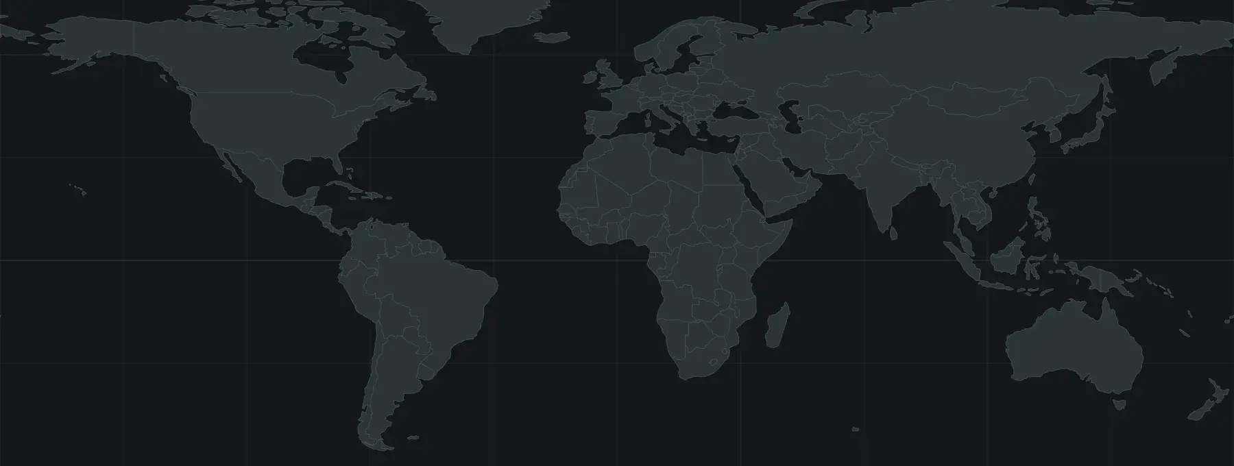
On the world map the same thing shows as a thick band of dots near the top and bottom. Of the 145 crossings, only six lie within 500 km of a major city in the tool's list of about 200.
The sample chart’s crossings on the world map
Each dot is a crossing. Rings mark the six crossings that lie within 500 km of a major city in the tool’s list of about 200.
 Saint PetersburgIzmirHarbinQuezon CitySanto Domingo
- Supportive pairs
- Mixed pairs
- Demanding pairs
- Within 500 km of a listed city
Is the sample chart unusual? Calculating 300 birth moments drawn between 1950 and 2005 gives a median of 12 listed cities within 500 km of some crossing, from 0 to 55, and one chart in 300 with none. The list holds roughly 200 large cities, so this counts those cities, not every town.
How many cities does a crossing usually reach?
Counting listed cities within 500 km of a crossing for 300 different birth moments, from 1950 to 2005:
The median chart has 12 such cities, with a range from 0 to 55. One chart in 300 has none at all.
What the sample chart's crossings look like
Four crossings from the worked chart show how to read the pair before the place. These are illustrations of the method, not predictions.
- Jupiter MC × Uranus ASC at 26.1°N, 88.4°E, about 313 km from Gazipur, 337 km from Dhaka and 396 km from Kolkata. A mixed pair: Jupiter's expansion with Uranus's change, traditionally read as growth that arrives by unexpected routes.
- Sun MC × Jupiter ASC at 60.5°N, 23.2°E, about 395 km from Saint Petersburg. Two supportive planets: visibility together with opportunity.
- Sun DSC × Moon ASC at 49.7°N, 127.5°E, about 444 km from Harbin. Another supportive pair, read as the public and the private self lining up.
- Sun MC × Pluto ASC at 40.8°N, 23.2°E, about 427 km from Izmir and 481 km from Istanbul. Visibility meeting intensity, a pairing that usually asks for more from the person.
Notice that the two Sun Midheaven crossings share a longitude and lie about 20° of latitude apart, because both sit on the same Sun line. One line can have many crossings, each with a different partner.
A crossing is a latitude too
A crossing lies at a particular latitude, and that latitude is where the two planets are on their angles at the same time during the day. Traditional astrologers call this relationship a paran and read it around the whole latitude circle, usually allowing about a degree of latitude either side. This guide and the tool report the point and the cities within 500 km of it, because that is the part you can check on a map.
Because planets move slowly across the sky relative to the Earth's rotation, the latitude of a crossing hardly changes with birth time, but the longitude does. Both lines shift east or west by about 15° for every hour. Slide the birth time in the figure below and watch the Jupiter MC × Uranus ASC crossing travel along its latitude.
A crossing slides east or west with the birth time
The crossing of Jupiter’s Midheaven line and Uranus’s Ascendant line is shown for the sample chart. Move the birth time an hour either way and watch what changes, and what does not.
An error of ten minutes moves this crossing about 250 km, and an hour moves it about 1,500 km. If your recorded time is a guess, no crossing is reliable. The birth time guide explains what survives an uncertain time, and the distance guide explains how quickly a line's effect is usually read to fade.
Using a crossing without over-reading it
How to use a crossing without over-reading it
1Calculate with an exact time
A crossing moves about 15° of longitude for each hour of birth time.
2Read the two planets together
The pair matters more than the city: warm and open, or demanding and focused.
3Check the distance
The effect is described as strongest within a few hundred kilometres of the point.
4Test the birth time
Move it ten or twenty minutes. A result that disappears is not worth planning around.
5Research the city
Cost, work, language, visas and people decide a move, not a line.
When you have a shortlist, put it beside the other evidence. The line distance calculator shows how far a city is from each of your lines, how to read astrocartography covers the four line types, and where to live ranks cities for a goal using the same lines.
What a crossing cannot do
A crossing cannot tell you where you will be happy, whom you will meet or whether a move will work. A city on a crossing with a supportive pair is not safer than a city with a demanding one; many people choose places that ask something of them. Astrocartography is a symbolic interpretive practice, not a validated predictor.
Used carefully, a crossing is a good prompt. It gives you a reason to look at a place you might have overlooked, and to ask what each of the two planets stands for in your own life. The answers come from visiting, talking to people who live there, and weighing cost and work, not from a point on a map.